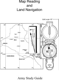
Army Field Manual FM 3-25.26 (U.S. Army Map Reading and Land Navigation Handbook)
The United States Army
If you want to be a competent soldier or understand soldiers, you have to appreciate terrain. Not just look at a landscape and say "gosh that's pretty", but understand the implications of ridgelines, intervisibility lines, the impact of terrain on movement, suitability of terrain for different applications, lines of sight, etc and understand it in a very visceral way, not just as academic subjects. And to understand land navigation, map reading is a sine qua non. Land navigation is an essential step in understanding terrain. Using compass, maps, protractors, pencils, and the land itself to figure out where you are, where you want to be, and how to get there (or where you don't want to be and how to avoid it), are the basic tools and tasks of land navigation, and the concepts and intellectual skill required are addressed in this book. Reading both the textual information on maps and making sense of the visual information on maps is discussed at length, but must be, to provide the neccessary background information for land navigation. As much as this is an essential skill for soldiers, this is an essential skill for understanding a soldier's world view. For example, an anthorpologist studying the Army, a member of the Air Force or Navy working with the Army, or leader in a humanitarian organization working with the Army would benefit from a useful set of skills that sheds light on a soldier's world view. I am, however, confused. I was under the impression that this edition of "Map Reading and Land Navigation" was restricted and not for release to the general public... N. B. All information in this review is common to earlier, unrestricted versions of this manual. E.M. Van Court P.S. Global Positioning System (GPS) is addressed. This is the last aspect of land nav that anyone should learn, and the pencil, paper, protractor, and compass should be mastered before touched one of these devices. Van
سال:
2001
ناشر کتب:
Digireads.com
زبان:
english
صفحات:
245
ISBN 10:
1420928236
ISBN 13:
9781420928235
سیریز:
U.S. Army Map Reading and Land Navigation Handbook
فائل:
PDF, 22.49 MB
IPFS:
,
english, 2001
 Amazon
  Barnes & Noble
  Bookshop.org
اپنی کتاب کی دکان شامل کرنا چاہتے ہیں؟ ہم سے support@z-lib.do پر رابطہ کریں۔
 فائل کنورٹر
 مزید تلاش کے نتائج
 دیگر فوائد


اہم جملے
متعلقہ بک لسٹیں